|
Luang Prabang City |
|
|
|
|
|
Address: |
|
|
|
|
|
Known as: |
|
|
|
|
|
Description: |
|
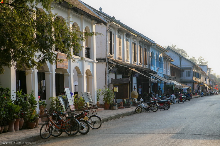
Luang Prabang is located in northern Laos at the heart of a
mountainous region. The town is built on a peninsula formed by
the Mekong and the Nam Khan River. Mountain ranges (in
particular the PhouThao and PhouNang mountains) encircle the
city in lush greenery.
Many legends are associated with
the creation of the city, including one that recounts that
Buddha would have smiled when he rested there during his
travels, prophesying that it would one day be the site of a rich
and powerful city. Known as Muang Sua, then Xieng Thong, from
the 14th to the 16th century the town became the capital of the
powerful kingdom of Lane Xang (Kingdom of a Million Elephants),
whose wealth and influence were related to its strategic
location on the Silk Route. The city was also the centre of
Buddhism in the region. Luang Prabang takes its name from a
statue of Buddha, the Prabang, offered by Cambodia.
After
the establishment of the French Protectorate in 1893, following
a period of turmoil during which the country was divided into
three independent kingdoms, Luang Prabang once again became the
royal and religious capital during the reign of King Sisavang
Vong. It played this role until Vientiane became the
administrative capital in 1946. |
|
|
Province |
|
Luang Prabang |
Direction: |
|
|
|
|
District |
|
Luang Prabang |
|
|
|
City |
|
Luang
Prabang |
Comments: |
|
Official Web: |
|
|
|
|
Genre |
|
Scenery |
|
|
Related links: |
|
|
|
|
Best exposure |
|
na |
|
|
|
|
|
|
|
Rating |
|
  |
|
|
|
|
|
|
|
Opening time |
|
na |
|
|
|
|
|
|
|
Entry fee |
|
na |
|
|
GPS : |
|
19.88548, 102.13685 |
|
| |
|
|
|
|
|
|
|
|
|
|
|