|
DALI area |
|
|
 |
Chongsheng temple
崇圣寺 |
|
GPS: |
25.70313,
100.1395 |
|
Chongshen Temple, is a Buddhist
temple near the old town of Dali
in Yunnan province, southern
China. It was once the royal
temple of the Kingdom of Dali,
originally built in the 9th
century. |
xxxxxxxxxxxxxxxxxxxxxxxx |
|
|
|
|
|
 |
Dali
Ancient City
大理古城 |
|
GPS: |
25.69406,
100.16719 |
|
Dali Ancient Town is one of the
most famous ancient towns in
China. As a major stop on the
Ancient Tea Horse Road, or
Southwest Silk Road, it is a
town full of historic sites and
traditional culture. |
 |
|
|
|
|
|
 |
Haidongzhen village
海东镇 |
|
GPS: |
25.71058, 100.26009 |
|
N/A |
|
|
|
|
|
|
 |
Erhai
Lake 洱海 |
|
GPS: |
25.79553,
100.18347 |
|
Erhai or Er Lake, is an alpine
fault lake in Yunnan province,
China. Its name means
"Ear-shaped Sea", due to its
shape as seen by locals and
travellers. Erhai was also known
as Yeyuze or Kunming Lake in
ancient times. |
 |
|
|
|
|
|
 |
Guanyin Oratory
(Guanyintang)
观音堂 |
|
GPS: |
25.65344,
100.18441 |
|
N/A |
|
|
|
|
|
|
 |
Qianxun
Pagoda 塔 |
|
GPS: |
25.70553,
100.14924 |
|
Qianxun Pagoda, 69.13 meters
high, is one of the highest
pagodas of the Tang Dynasty (618
- 907) |
|
|
|
|
|
|
 |
Shapingcun market
沙坪村 |
|
GPS: |
25.93893, 100.09819 |
|
N/A |
|
|
|
|
|
|
 |
Cang shan
苍山兰 |
|
GPS: |
25.71839,
100.0737 |
|
Cang Mountains (Cangshan) are a
mountain range west of Dali
City. Their snow-capped peaks,
flowing clouds, murmuring
brooks, diverse flora, and
historical temples make them one
of the most famous attractions
in Dali. |
 |
|
|
|
|
|
 |
Luoquan Peninsula -
Guanyin Pavilion (Goddess of
Mercy)
罗荃半岛 |
|
GPS: |
25.60195,
100.23767 |
|
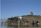
This small peninsula is on the
eastern shore of Er'hai Lake.
It's one of the best places to
enjoy the grand views of
Cangshan Mt and Er'hai Lake.
Main draws on the isle are
Tianjing (Mirror of Heaven)
Pavilion, Guanyin (Goddess of
Mercy) Pavilion, Taizi (Prince)
Pavilion, Baxian (Eight
Immortals) Pavilion, Luoquan
Pagoda, Luoquan Temple, and the
Stone Mule etc. |
|
|
|
|
|
|
 |
Three
Pagodas
崇圣寺三塔 |
|
GPS: |
25.70618,
100.14944 |
|
The Three Pagodas of the
Chongsheng Temple are an
ensemble of three independent
pagodas arranged on the corners
of an equilateral triangle, near
the old town of Dali, Yunnan
province, China, dating from the
time of the Kingdom of Nanzhao
and Kingdom of Dali in the 9th
and 10th centuries. |
 |
|
|
|
|
|
 |
Wase market
挖色镇 |
|
GPS: |
25.82742, 100.22305 |
|
Saturday market at the Bai
village of Wase. |
|
|
|
|
|
|
 |
Xizhou
market |
|
GPS: |
25.85033,
100.13069 |
|
The Xizhou morning marke show
you all kinds of product from
groceries and daily commodities
to handicrafts etc. Yet, the
most attracted point should be
the experience of the
traditional dressing of Bai
minority women. |
|
|
|
|
|
|
 |
Xizhouzhen Village
喜洲镇 |
|
GPS: |
25.85127,
100.1289 |
|
The Town of Xizhou is in north
of the ancient city of Dali,
lies between beautiful Erhai
Lake and Cangshan Mountain. It
is a great place to if you want
to observe the typical Bai
architecture and understand Bai
ethnic culture. |
|
|
|
|
|
|
 |
Zhoucheng
(batik)
洲城 |
|
GPS: |
25.89722,
100.10751 |
|
In the region of Dali, exactly
23 km north of the old town of
Dali, and north west of Lake
Erhai, lies the very pleasant
village of Zhoucheng. This
village is home to around 1,500
families living in beautiful
houses in Bai style, and is one
of the largest villages in the
entire region. Zhoucheng Village
is famous as the 'Hometown of
Bai People's Tie-dyeing Art'. |
 |
|
|
|
|
|
 |
Zhoucheng market |
|
GPS: |
25.89636, 100.10775
|
|
A small market is held in the
central village square every day
in the afternoon, in the shade
of huge plane trees. |
|
|
|
|
|
|
|
JIANSHUI area |
|
|
 |
Shuanglong Bridge (Twin Dragons
Bridge)
建水县 |
|
GPS: |
23.60809, 102.7932 |
|
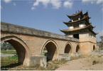
Seventeen-Arch Bridge, also
known as Shuanglong Bridge, is a
bridge with 17 arches and 3
pavilions. It crosses above the
injunction of Lu River and
Tachong River which looks like
two Chinese dragons, hence the
name Shuanglong Bridge. The
Seventeen-Arch Bridge was
originally built in the ruling
period of Qinglong Emperor of
Qing Dynasty. It was just 3
arches at that time. Along with
the floods of Lu River and
Tachong River, the bed of the
river became wider and wider.
The three-arch bridge could not
connect the banks. In 1939,
local officers and people built
other 14 arches connect with the
tree arches bridge and it became
the Seventeen-Arch Bridge. |
 |
|
|
|
|
|
 |
Residence
famille Zhu
朱家花园 |
|
GPS: |
23.61598,
102.82747 |
|
Situated on Hanlin Street, Zhu’s
Family Garden is a family house
and ancestral hall built by Zhu
family in the late Qing Dynasty
(1636-1912). It has a good
reputation in south Yunnan for
the exquisite buildings and
beautiful garden. It totally has
42 patios and 214 houses. The
layout of the whole garden is
complex but well-arranged. |
|
|
|
|
|
|
 |
Jianshui Confucius Temple
建水文庙 |
|
GPS: |
23.61196,
102.82364 |
|
Jianshui Confucius Temple was
originally constructed in 1285
and has renovated and extended
for over 40 times, covering an
area of 114mu. It is one of the
well preserved Confucius Temples
in large scale and high
architectural level. |
 |
|
|
|
|
|
 |
Chaoyang
Tower
建水朝阳楼 |
|
GPS: |
23.6166,
102.831 |
Chaoyang Tower was constructed
in the 22nd year of Hongwu reign
in Ming Dynasty. It has a
history of 600 years. Located in
the center of Jianshui County,
Chaoyang Tower serves as the
landmark of the ancient Jianshui
County.
Chaoyang Tower covers
an area of 2,312 square meters.
It is 77 meters long in the
north and south direction, 26
meters wide in the east and west
directions. Styled in the Ming
Dynasty, Chaoyang has four gates |
 |
|
|
|
|
|
 |
Jianshui City (Others)
建水县 |
|
GPS: |
23.61492, 102.82048 |
|
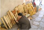
The ancient city of Jianshui,
known as Lin'an historically, is
a famous city with a profound
historical and cultural
background. It is located in
Jianshui County in Honghe
Prefecture. The ancient city of
Jianshui is listed as a National
Historical and Cultural City. It
has been in existence for twelve
centuries. |
 |
|
|
|
|
|
 |
Jianshui Countryside |
|
GPS: |
23.61492, 102.82048 |
|
N/A |
 |
|
|
|
|
|
|
KUNMING area |
|
|
 |
Western Hills (Xishan Forest
Park)
西山森林公园
|
|
GPS: |
24.975,
102.62354 |
|
Western Hill is a forest park, a
beautiful place with fabulous
views. You can overlook the Dian
Lake on the Western Hill, and
there are also wonderful
temples. The most amazing part
is the Dragon Gate on the top of
Western Hill. |
 |
|
|
|
|
|
 |
Black
Dragon Pool
黑龙潭 |
|
GPS: |
25.13817,
102.74654 |
|
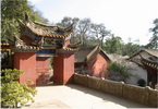
The Black Dragon Pool first
became a popular tourist
attraction over 700 years ago
during the Ming Dynasty. The
Black Dragon Pool was named
after a legend stating that in
ancient times there was a black
dragon living in this pool. Two
important building complexes in
the Black Dragon Pool are the
Longquan Temple (Dragon Spring
Temple) and Black Dragon Palace. |
 |
|
|
|
|
|
 |
East Pagoda
东寺塔 |
|
GPS: |
25.02887, 102.71225 |
|
East Temple Pagoda used to be in
Changle Temple on Shulin Street
in Kunming City. Changle Temple
was also called East Temple,
thus the pagoda's name.
According to historical records,
the temple and pagoda were built
at the same time as the West
Temple and Pagoda, but the
pagoda was destroyed in a strong
earthquake in 1833. In 1882 it
was rebuilt. |
 |
|
|
|
|
|
 |
West
Pagoda
西寺塔 |
|
GPS: |
25.02909,
102.7089 |
|
In the ancient city of Kunming
stand two ancient pagodas, one
in the east and the other in the
west. West Pagoda used to be
located in the now nonexistent
Huiguang Temple. The temple used
to be called West Temple, so the
pagoda was named West Temple
Pagoda. Now only the pagoda
remains.Historical records show
that both the temple and the
pagoda were built between 824
and 859 in the Tang Dynasty. |
 |
|
|
|
|
|
 |
Dagan Park (Grand View
Park)
大观公园 |
|
GPS: |
25.02312,
102.67126 |
|
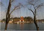
Daguan Park is a lakeside park
located in the southwestern
suburb of Kunming, Yunnan,
China. Today many locals come to
sit, drink tea, fly kites, and
go boating. |
 |
|
|
|
|
|
 |
Shilin
(Stone Forest) 石林 |
|
GPS: |
24.81731,
103.32492 |
|
Stone Forest started the
formation from about 270 million
years ago, and after a long
period of geological evolution
and complex paleogeography and
environment evolution, the
precious geological relics had
finally been formed.. |

 |
|
|
|
|
|
 |
Yanquan Temple
岩泉禅寺 |
|
GPS: |
24.92373, 103.12742 |
|
Yanquan Scenic Area used
to be the temporary palace for
Mr. Wu Sangui (1612-1678) and
his lover Ms. Chen Yuanyuan
(1623-1695) in the Qing Dynasty
(1644-1911).Yanquan Buddhist
Temple was originally erected in
the Yuan Dynasty (1253-1368) by
Master Chongzhao (1299-1364)-the
founder of Panlong Buddhist
Temple in Jinning County-for the
purpose of promoting Buddhism. |
|
|
|
|
|
|
 |
Bamboo
Temple (Qiongzhu Temple)
筇竹寺 |
|
GPS: |
25.0624,
102.6213 |
|
Qiongzhu Temple, or Bamboo
Temple, is a Buddhist temple
situated on Yu'an Mountain to
the northwest of Kunming. The
name of the temple refers to a
type of bamboo. The Bamboo
Temple was established during
the Yuan dynasty as the first
temple dedicated to Zen Buddhism
in Yunnan. |
 |
|
|
|
|
|
 |
Golden Temple
金殿 |
|
GPS: |
25.08846, 102.77173 |
|
The Golden Temple is a Taoist
temple which is the reproduction
of the principal pavilion of a
first sanctuary. This Taoist
Temple is founded in 1602 during
the Ming dynasty, and
transported in 1602 on Jizu
Shan, a sacred mountain around
Dali, before being rebuilt on
the original spot. |
 |
|
|
|
|
|
 |
Huating
Temple 华亭寺 |
|
GPS: |
24.97141,
102.62771 |
|
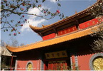
The Huating Buddhist Temple is
an ancient Buddhist temple that
was originally a retreat for the
local ruler. It is one of the
best-preserved Buddhist temples
in Kunming. The 900-year-old
temple was originally designed
as a county temple for Gao
Zhishen, Kunming's governor
during the Song dynasty
(1063AD). It was rebuilt as a
Buddhist temple in the
fourteenth century. |
|
|
|
|
|
|
 |
Taihua Temple
太华寺 |
|
GPS: |
24.96182, 102.62953 |
|
Taihua Temple is one of the most
important birthplaces of
Buddhist culture in Yunnan.
Built in the Yuan Dynasty
(1206-1370), the temple has been
undergone many reconstructions.
Since the construction of the
temple over seven Centuries ago,
numerous renovations have taken
place here. |
 |
|
|
|
|
 |
Yuantong
Temple
圆通寺 |
|
GPS: |
25.05091,
102.71178 |
|
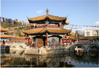
The temple was built during the
Tang Dynasty, with a history
spanning over 1,200 years.
During the Ming and Qing
Dynasties, the temple was
reconstructed and repaired
several times to its present
size and appearance. The temple
is now one of the most important
Buddhist temples under State
special protection. |
 |
|
|
|
|
|
 |
Dian Lake
滇池 |
|
GPS: |
24.88758,
102.73298 |
|
Dianchi Lake, also known as Lake
Dian and Kunming Lake, is a
large lake located on the
Yunnan-Guizhou Plateau close to
Kunming, Yunnan, China. Its
nickname is the "Sparkling Pearl
Embedded in a Highland" and it
was the model for the Kunming
Lake in the Summer Palace in
Beijing. |
 |
|
|
|
|
|
 |
Kunming city (Others)
昆明市 |
|
GPS: |
25.04287,
102.70649 |
|
Kunming, the modern capital city
and transportation hub of
China’s southern Yunnan
province, has a large student
population and a temperate
year-round climate. As of 2014,
Kunming has a population of
6,626,000 with an urban
population of 4,575,000. |
 |
|
|
|
|
|
|
LIJIANG area |
|
|
 |
Baisha Village
白沙村 |
|
GPS: |
26.95286,
100.2176 |
|
Baisha Village used to be a Naxi
settlement and the birthplace of
local Mu Family Governors. It
was the political, economic and
cultural center of Lijiang prior
to the Ming Dynasty (1368 -
1644). Its construction started
during the Tang Dynasty (618 -
907) and it became prosperous
during the Song (960 - 1279) and
Yuan (1271 - 1368) Dynasties. |
 |
|
|
|
|
|
 |
Black
Dragon Pool
黑龙潭 |
|
GPS: |
26.88555,
100.23356 |
|
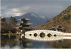
Black Dragon Pool is a famous
pond in the scenic Jade Spring
Park located at the foot of
Elephant Hill, a short walk
north of the Old Town of
Lijiang. |
 |
|
|
|
|
|
 |
Dongba garden (Dongba
Wanshenyuan)
东巴万神园 |
|
GPS: |
26.99803, 100.21165 |
|
Dongba 10000 Gods Garden or
Dongba Wanshen Garden Park is
surrounded by green grass, pine,
herb Yan Yan, flowers are
blooming. God park at the main
entrance are two giant totem
poles and snow-capped mountains
form a main axis peak. |
 |
|
|
|
|
|
 |
Dragon
Jade Mountain
玉龙雪山 |
|
GPS: |
27.09833,
100.17499 |
|
Jade Dragon Snow Mountain is a
mountain massif or small
mountain range in Yulong Naxi
Autonomous County, Lijiang, in
Yunnan province, China. Its
highest peak is named Shanzidou
and is 5,596 m above sea level. |
 |
|
|
|
|
|
 |
Lijiang Ancient Town
丽江古城 |
|
GPS: |
26.86811,
100.23977 |
|
Lijiang Old Town, also called
Dayan Old Town, is a
well-preserved ancient town for
Naxi ethnic group. Old Town of
Lijiang was listed as UNESCO
World Heritage Site in 1997,
including Dayan Old Town, Shuhe
Old Town and Baisha Old Town. It
is one of the four
best-preserved ancient cities in
China. |
 |
|
|
|
|
|
 |
Lijiang
New City
丽江 |
|
GPS: |
26.83136,
100.23252 |
|
Lijiang is a prefecture-level
city in the northwest of Yunnan
province, China. It has an area
of 21,219 square kilometres and
had a population of 1,244,769 at
the 2010 census whom 211,151
lived in the built-up area. |
 |
|
|
|
|
|
 |
Ancient City Zhongyi Market
忠义市场 |
|
GPS: |
26.86618, 100.23546 |
|
N/A |
|
|
|
|
|
|
 |
Yufeng Monastery
玉峰寺 |
|
GPS: |
26.99192,
100.19526 |
|
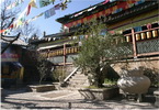
Yufeng Temple was built in the
last years of the reign of
emperor Kangxi in Qing dynasty
and it is one of the famous lama
temples in Lijiang. The temple
is small, but it was famous due
to a camellia. There are three
courtyards in the temple, the
famous "camellia" rooted in the
north courtyard. |
 |
|
|
|
|
|
 |
Naxi Ancient Music |
|
GPS: |
na |
The Naxi are an ethnic group
inhabiting the foothills of the
Himalayas in the northwestern
and southwestern parts of
Southwest China's Yunnan and
Sichuan provinces respectively.
Naxi ancient music is believed
to have its roots in Xian
ancient music. However, Naxi
ancient music, with its mixture
of literary lyrics, poetic
topics, and musical styles from
the Tang (618-907) and Song
dynasties (960-1279), as well as
some Tibetan influences, has
developed its unique style. |
 |
|
|
|
|
|
 |
Wanggu
Pagoda
万古楼 |
|
GPS: |
26.87042,
100.23266 |
|
Wangu Pagoda can easily be
reached from Sifan Square. The
pagoda is situated at Lion Hill
in a small park and has
excellent views over Lijiang.
The tower is 4 stories high. |
|
|
|
|
|
|
 |
The Stone Drum in Shigu Town |
|
GPS: |
na |
|
Built during the Jiaqing era
(1548-1561) of the Ming Dynasty,
the stone drum is a monument
commemorating the victory of
Lijiang’s Naxi ruler over an
invading Tibetan army. |
 |
|
|
|
|
|
 |
Yu
Zhuqingtian
玉柱擎天 |
|
GPS: |
27.01317,
100.20739 |
|
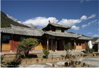
Yuzhuqingtian (Jade Pillar
Supporting the Sky) is located
in Yuhu Naxi Village at the
south foot of the Jade Dragon
Snow Mountain. Major sights
there include inscriptions on
the cliff, Taizi (Prince) Cave
and Guanyin (God of Mercy) cliff
etc. Yuzhuqingtian-Jade Pillar
Supporting the Sky On a
30-meter-high cliff, one can see
four big Chinese characters -"Yu
Zhu Qing Tian" (Jade Pillar
Supporting the Sky) vertically
inscribed. |
|
|
|
|
|
|
 |
Tiger Leaping gorge
虎跳峡 |
|
GPS: |
27.18939,
100.11387 |
|
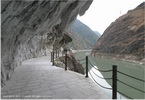
Tiger Leaping Gorge is a scenic
canyon on the Jinsha River, a
primary tributary of the upper
Yangtze River. It is located 60
kilometres north of Lijiang
City. |

 |
|
|
|
|
|
 |
Village
around Lijiang |
|
GPS: |
na |
|
N/A |
|
|
|
|
|
|
 |
Yangtze River - Shigu
长江 |
|
GPS: |
26.86815, 99.9621 |
|
The First Bend of the Yangtze
River is only about 50
kilometers away from Lijiang. It
is called the “first bend”
because the river makes a 90
degree turn from south to east
within a distance of 1
kilometer. |
 |
|
|
|
|
|
 |
Zhiyun Monastery
指云寺 |
|
GPS: |
26.85869,
100.10107 |
Zhiyun Monastery is situated in
the west of Lijiang near Lashi
Basin. It was built in 1727
during the Qing Dynasty and was
made up of thirteen different
structures. However only six
structures remaining intact
today.
This monastry is
unquie in design. It differs
from the traditional Tibetan
architecture as all the carvings
and structural designs were
taken from the Naxi, Han and Bai
people. |
|
|
|
|
|
|
|
XISHUANGBANNA area |
|
|
 |
Damenglong 大勐龙 |
|
GPS: |
21.57918,
100.68409 |
|
The sleepy town of Damenglong is
located about 60km south of
Jinghong, the capital of the
Xishuangbanna autonomous region. |
|
|
|
|
|
|
|
|
|
|
Pagodas |
|
GPS: |
21.57918,
100.68409 |
|
The Manfeilong Pagoda is located
approximately 3km north of
Damenglong on a hill and is
almost entirely surrounded by
rubber tree plantations. There
is another Pagoda right above
the town which offers nice views
of the Damenglong at the
surroundings.“ Manfeilong” or
“White Bamboo Shoot” Pagoda
reportedly dating back to the
early 13th century. |
 |
|
|
|
|
|
|
|
Damenglong City
大勐龙 |
|
GPS: |
21.57918, 100.68409 |
|
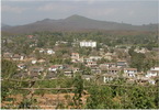
The sleepy town of Damenglong is
located about 60km south of
Jinghong, the capital of the
Xishuangbanna autonomous region. |
 |
|
|
|
 |
Ganlanba (Menghanzhen) 勐罕镇
(橄榄坝大) |
|
GPS: |
21.8519, 100.94375 |
|
Olive Dam (Ganlanba) is the
lowest and hottest place in this
area. However, its torrid
climate brings rich tropical
fruits and products. It consists
of two stockaded villages, each
of which is highlighted by an
eyeful of typical Burma styled
Buddhist pagodas and bamboo
building of the Dai minority. |
|
|
|
|
|
|
 |
Jinghong
景洪市 |
|
GPS: |
22.00315,
100.79244 |
|
Jinghong is a modern town
displaying newly built
glittering tawdry hotels and
mega-blocks. Despite of that,
Jinghong tends to be an
agreeable city thanks to large
shady avenues, giant palm trees
and nice walking paths along the
Mekong. |
 |
|
|
|
|
|
|
|

|
Tropical Garden
西双版纳热带花卉园 |
|
GPS: |
22.00718,
100.78587 |
|
Tropical Flower & Plant Garden
occupies an area of about 80
hectares. This park once was the
experimental field of Yunnan
Tropical Crops Institute. With
all kinds of nice tropical
flowers and ornamental plants
cultivated with their
advantageous technology, it was
opened to public as a park in
1999. |
 |
|
|
|
|
|

|
Manting
Park
曼听公园 |
|
GPS: |
21.99253, 100.80722 |
|
Manting Park covers a total area
of 115,400 square meters.
Manting Park is the oldest park
in Xishuangbanna with a long
history of 1300 years. It used
to be the Dai Imperial Garden
and the place for the emperor to
please the eyes in the ancient
times. |
 |
|
|
|
|
|
|
|
|
|
Traditionnal Dances Show |
|
GPS: |
na |
|
N/A |
 |
|
|
|
|
|
|
|
Manting
Foya Temple (Wat Changliarn)
曼听佛牙寺 |
|
GPS: |
21.99435, 100.8075 |
|
N/A |
 |
|
|
|
|
|
|
|
|
|
Others |
|
GPS: |
na |
|
N/A |
 |
|
|
|
 |
Jingzhen Octagonal Pavilion
景真八角亭 |
|
GPS: |
21.95435,
100.30502 |
|
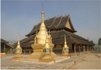
The Jingzhen Octagonal Pavilion
was built in 1701 during the
Qing Dynasty (1644-1911) -- the
year 1063 according to the Dai
calendar. It was originally
built in a local Hinayana
temple, but the temple was
destroyed. The pavilion has
retained its former features
following three large-scale
repairs. |
 |
|
|
|
|
|
 |
Manfeilong Pagoda
游览曼飞龙塔 |
|
GPS: |
21.71384,
100.7448 |
|
Manfeilong Pagoda was first
built in 1204 (565 in the Dai
calendar). It was designed by
three monks from India and the
design was executed under the
sponsorship of the chieftain of
Menglong tribe. After two
renovates in modern times, the
pagoda was listed as a national
key cultural relic preservation
site. |
 |
|
|
|
|
|
 |
Manjingian village |
|
GPS: |
na |
|
N/A |
|
|
|
|
|
|
 |
Sanchahe Nature Reserve
野象谷索道 |
|
GPS: |
22.16811,
100.8622 |
|
Covering 1.5 million hectares,
the Sanchahe Nature Reserve is
dived into two parts, which are
connected by a long cable car.
Riding the aerial cable car is a
fun and exciting way to see the
nature reserve. |
 |
|
|
|
|
|
|
YUANYANG area |
|
|
 |
Yuanyang
Market |
|
GPS: |
23.10155,
102.74413 |
|
Going to the morning market is
particularly of great
significance for the majority of
Yuanyang women. It is them,
wearing the colorful costumes
and carrying their bamboo
baskets (Zhulou) to bring all
sorts of items from home to the
market in exchange for what they
need. |
|
|
|
|
|
|
 |
Rice-paddy terraces (1)
元阳梯田 |
|
GPS: |
23.10155,
102.74413 |
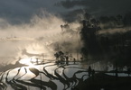
Yuanyang Rice Terraces are the
Hani ethnic minority's
masterpiece of ingenuity. In
unique shapes and sizes with
thousands of years of history,
they form a mosaic of colorful
and breathtaking landscapes of
natural beauty.
Known as a
"land sculpture", the terraced
fields have been officially
acknowledged by UNESCO as a
World Cultural and Natural
Heritage Site. There are three
popular scenic areas: Duoyishu,
Bada, and Laohuzui. |
 
 |
|
|
|
|
|
 |
Rice-paddy terraces (2)
元阳梯田 |
|
GPS: |
23.10155,
102.74413 |
|
For more than one thousand
years, the Hani people of
Yuanyang county have expanded to
grow their rice paddy field on
the steep slopes in the rural
areas. From the viewing
platform, one could see an
expanse of beautiful terraced
paddy field, stretched from
valley’s bottom up to the higher
reaches of nearby mountains,
towards the distant horizon in
an area of more than 113 square
kilometers. |
 |
|
|
|
|
|
 |
Rice-paddy terraces (3)
元阳梯田 |
|
GPS: |
23.10155,
102.74413 |
|
N/A |
 |
|
|
|
|
|
 |
Rice-paddy terraces (4)
元阳梯田 |
|
GPS: |
23.10155,
102.74413 |
|
N/A |
 |
|
|
|
|
|
 |
Yuanyang Village
元阳 |
|
GPS: |
23.10155, 102.74413 |
|
Yuanyang County is located in
Honghe Prefecture in
southeastern Yunnan province,
China, along the Red River. It
is well known for its
spectacular rice-paddy
terracing. Part of the area now
forms the 45th World Heritage
Site in China. |
|
|
|
|
|
|
 |
Village Hani |
|
GPS: |
23.10155,
102.74413 |
|
The Hani people, famous for
their farm work and the building
of the rice terraces has similar
traditions as the Yis. The farm
work is often done by the women,
while the men are more
responsible for taking care of
the family's kids. |
|
|
|
|
|


