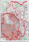
|
PORTRAITS AND PEOPLES |
|
|
 |
Portraits and Peoples |
|
GPS: |
na |
|
N/A |
|
|
|
|
|
|
|
GUIDE area |
|
|
 |
Cemetery of Revolutionary
Martyrs |
|
GPS: |
36.04918,
101.42956 |
|
N/A |
|
|
| |
|
|
|
|
|
|
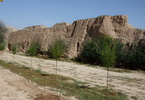 |
City
walls and Gates |
xxxxxxxxxxxxx |
GPS: |
na |
|
Gui'de County is is under the
administration of Hainan Tibetan
Autonomous Prefecture. The area
became part of Ming Dynasty
China in 1370, and the city's
earthen walls and buildings were
built between 1375 and 1380. The
city was enlarged in 1590. After
the founding of the People's
Republic, the moats were filled
in and the North and South gates
were pulled down. In 2010 work
commenced to restore the gates
and towers. |
|
|
|
|
|
|
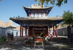 |
Confucius Temple 文庙 |
|
GPS: |
na |
|
N/A |
|
|
|
|
|
|
 |
Giant
Praying drum |
|
GPS: |
na |
|
N/A |
|
|
|
|
|
|
 |
Guìdé city 贵德 |
|
GPS: |
36.04017, 101.43271 |
Guide County in Tibetan it's
known as Trika.
The area
became part of Ming Dynasty
China in 1370, and the city's
earthen walls and buildings were
built between 1375 and 1380. The
city was enlarged in 1590. After
the founding of the People's
Republic, the moats were filled
in and the North and South gates
were pulled down, as well as the
towers. . |
|
|
|
|
|
|
 |
Jade
Emperor temple (Yùhuáng Gé)
玉皇阁 |
|
GPS: |
36.04729,
101.43047 |
|
Formerly named as Wangshou Guan,
the Yuhuang Pavilion of Guide
County was initially built
during the reign of Emperor
Wangli in Ming dynasty (1592).
It is over 400 years old.
Without modifying the original
conditions of the pavilion, the
renovation shall be conducted in
the principle of maintain
original architectural style,
original building material and
original techniques. |
|
|
|
|
|
|
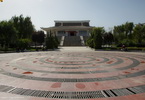 |
Museum of Guìdé County |
|
GPS: |
36.04648,
101.42771 |
|
The square beside the temple
contains the small museum, which
houses a handful of interesting
Ming and Qing artefacts
recovered from the local area,
but lacks English captions. |
|
|
| |
|
|
|
|
|
|
 |
Tibetan
temple |
xxxxxxxxxxxxx |
GPS: |
36.04622,
101.41996 |
|
N/A. |
|
|
|
|
|
|
 |
Wetland |
|
GPS: |
na |
|
N/A. |
|
|
|
|
|
|
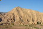 |
Xining-Guide road |
|
GPS: |
na |
|
N/A |
|
|
|
|
|
|
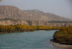 |
Yellow River
(Jìngǎng Xiàn) 进港线 |
|
GPS: |
36.05483, 101.42454 |
|
The Yellow River or Huang He is
the second-longest river in
Asia, following the Yangtze
River, and the sixth-longest in
the world at the estimated
length of 5,464 km. Originating
in the Bayan Har Mountains in
Qinghai province of western
China, it flows through nine
provinces, and it empties into
the Bohai Sea near the city of
Dongying in Shandong province. |
|
|
|
|
|
|
|
KANBULA National Park |
|
|
 |
National Forest Park
坎布拉国家森林公园 |
|
GPS: |
36.10476,
101.78802 |
|
The Kanbula National Forest Park
is 2,100 to 4,00 meters above
sea level, covering an area of
about 4,774 hectares. It borders
on the Yellow River in the
north, abutting against the
famous Liajiaxia Hydroelectric
Power Station. The surface of
the rock is as red as the red
glow. The mountains take on
various shapes. |
|
|
|
|
|
|
 |
Villages
and Village life |
|
GPS: |
na |
|
N/A |
|
|
|
|
|
|
 |
Xining to Kanbula park Road |
|
GPS: |
na |
|
N/A |
|
|
|
|
|
|
|
LEDU area |
|
|
 |
City God Temple 城隍庙 |
|
GPS: |
36.4818,
102.39884 |
|
N/A. |
|
|
|
|
|
|
 |
Gautama
Temple (Qutan Temple) 瞿昙寺 |
|
GPS: |
36.35729,
102.29403 |
|
Gautama Temple is is famous for
magnificent buildings, fine
fresco and valuable cultural
relics. Its architectural style
is very similar to the Forbidden
City in Beijing, so it enjoys
the title of ‘Small Forbidden
City. |
|
|
|
|
|
|
 |
Liuwan Tombs
柳湾墓地 |
|
GPS: |
36.45291, 102.55578 |
|
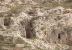
The Liuwan Tombs is the largest
tombs of primitive China, which
are well preserved. The tombs
cover an area of 110,000 square
meters. There are more than
1,500 tombs with 30,000 relics
unearthed belonging to the
cultures of Majiayao, Machang,
Qijia, and Xindian. |
|
|
|
|
|
|
 |
Xining Xilai Temple
西来寺 |
|
GPS: |
36.48097,
102.40815 |
|
It was built in 1606 and located
in the Dongguan Street of Ledu
District. |
|
|
|
|
|
|
|
PING-AN area |
|
|
 |
Dalai Lama birth village
达赖故居 |
|
GPS: |
36.37827,
101.86674 |
|
The current Dalai Lama was born
in Taktser. It is an
unremarkable Tibetan village
perched on the edges of the
Tibetan plateau. The Dalai Lama
came from an ordinary farming
family, and had an ordinary
childhood until he was
recognized as the reincarnation
of the previous Dalai Lama. |
 |
|
|
|
|
|
 |
Pinganxia
Temple
青海省峡群寺森林 |
|
GPS: |
36.34493,
101.92409 |
|
Xiaqiong lamasery is also called
"ShaChong lamasery" is
situated in Hualong hui
nationality autonomous county,
170km far away from XiNing .It
is one of the five greatest
lamaseries of the yellow sect of
Tibetan Buddhism in Qinghai and
renowned for the many buildings
and the good location. |
 |
|
|
|
|
|
 |
White horse temple
白马寺 |
|
GPS: |
36.52101, 102.10336 |
|
White Horse Temple (Fat Jong Si)
is a Buddhist complex carved
into the end of a mountain range
located in Ping'an County of
Qinghai Province, on the Tibetan
Plateau. |
|
|
|
|
|
|
 |
Youning |
|
GPS: |
36.76006,
102.17426 |
|
N/A |
|
|
| |
|
|
|
|
|
|
|
City temple |
|
GPS: |
36.76084,
102.17434 |
|
N/A |
 |
|
|
|
|
|
|
|
Youning area |
|
GPS: |
na |
|
N/A |
 |
|
|
|
|
|
|
|
Youning Si 佑宁寺 |
|
GPS: |
36.75774,
102.18509 |
|
Youning Temple, with the full
name of Guolong Milezhou Temple
in Tibetan language and Guolong
Temple for short, is a holy
place of Tu People in Huangshui
Valley, Qinghai Province and
regarded as “the mother of
temples in Huangbei”. |
 |
|
|
|
|
|
|
|
Youning town |
|
GPS: |
36.76006,
102.17426 |
|
N/A |
 |
|
|
|
|
|
|
|
Youning-Pingan road |
|
GPS: |
na |
|
N/A |
 |
|
|
|
|
TONGREN area |
|
|
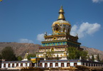 |
Gomar Gompa
郭麻日寺 |
|
GPS: |
35.56743,
102.04279 |
|
This is 400 year old and looks
like an ancient walled village.
130 monks are supposed to be
housed here but people have
remarked that it seems to be
deserted. |
|
|
|
|
|
|
 |
Longwu
monastery (Rongwo
Gonchen Gompa)
隆务寺 |
|
GPS: |
35.50834,
102.01126 |
|
The Rongwo Gompa is the main
monastery in Tongren and an
amazing architectural design. It
is a labyrinth of restored
halls, chapels and the
residences of the monks who live
here. It was constructed in
1301. |
|
|
|
|
|
|
 |
Wutun Sì 吾屯寺 |
|
GPS: |
35.56065, 102.05732 |
|
Wutun Si is divided into two
monasteries, Upper (Yango)
Monastery which is closer to
town, and the Lower (Mango)
Monastery. |
|
|
|
|
|
|
|
|
|
|
XINING area |
|
|
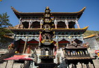 |
Beichan Sì (Tulou Temple)
北禅寺 |
|
GPS: |
36.64051,
101.78454 |
|
The Northern Buddhist Temple is
the earliest example of
religious architecture in
Qinghai Province. Covering an
area of nearly 28,000 square
meters (about 6.9 acres), the
temple was built during the
Northern Wei Dynasty along a
natural fault-line in Northern
Mountain, from which the temple
it takes its name. |
|
|
| |
|
|
|
|
|
|
 |
City
walls (Chéngqiáng)
城墙 |
xxxxxxxxxxxxx |
GPS: |
na |
|
One or two isolated sections of
Xīníng’s old city wall still
remain, the most accessible
being a short stretch on Kunlun
Zhonglu. |
|
|
|
|
|
|
 |
Confucius Temple |
|
GPS: |
na |
|
N/A |
|
|
|
|
|
|
 |
Golden Stupa Temple (Jīntǎ
Sì) 金塔寺 |
|
GPS: |
36.61732,
101.78382 |
|
Small temple named after
long-destroyed golden chörten
(Tibetan stupa). Used as a place
of study by monks. |
|
|
|
|
|
|
 |
Great Mosque (Qīngzhēn Dàsì
/ Dongguan Mosque)
清真大寺 |
|
GPS: |
36.61534, 101.79738 |
|
The Great Mosque of Xining is
one the four largest mosques in
northwest China. Locally, it is
known as the East Gate Mosque.
According to an inscription
added to the mosque during a
major reconstruction in 1914,
the mosque was first built
during the Ming Dynasty under
Emperor Hongwu (1368-98). |
|
|
|
|
|
|
 |
Great Mosque market |
|
GPS: |
36.61583,
101.79765 |
|
N/A |
|
|
|
|
|
|
 |
Nanshan Hill
南山寺 |
|
GPS: |
36.60101,
101.77295 |
|
Nanshan Park is located at the
south part of Phoenix Mountain,
2,419 meters above sea level.
The thick growth of trees
(mainly Chinese pine, polar and
elm) provide a relaxing
environment away from the city,
which can be viewed clearly from
this unique position high in the
mountains. |
|
|
| |
|
|
|
|
|
|
|
Fazhuang temple |
|
GPS: |
na |
|
N/A |
 |
|
|
|
|
|
|
|
Gongbei mosque |
|
GPS: |
na |
|
N/A |
 |
|
|
|
|
|
|
|
Nachang park
南山公园 |
|
GPS: |
36.60101,
101.77295 |
|
Nanshan Park is located at the
south part of Phoenix Mountain,
2,419 meters above sea level.
The thick growth of trees
(mainly Chinese pine, polar and
elm) provide a relaxing
environment away from the city,
which can be viewed clearly from
this unique position high in the
mountains. |
 |
|
|
|
|
|
|
|
Nanchan Temple |
|
GPS: |
36.61478,
101.76963 |
|
Nanshan temple is another quaint
temple, which lies in front of
Nanshan Park. For a nice view of
Xining from the south, from the
temple you can walk up to the
peak of the park. |
 |
|
|
|
|
|
|
|
Tibetan temple |
|
GPS: |
na |
|
N/A |
 |
|
|
|
|
|
|
|
Hilltop building |
|
GPS: |
na |
|
N/A |
 |
|
|
|
 |
Shuijing Xiang Market |
xxxxxxxxxxxxx |
GPS: |
36.62087,
101.77665 |
|
The Shuijing Ally
(Shui-Jing-Xiang) is the biggest
free market in Xining. At the
entrance of two intersecting
alleys, each more than 1,100 m
long, are more than 3,000 fixed
stalls. The market has
everything from food and drink
to articles for daily use. |
|
|
|
|
|
|
 |
Ta-er Si (Kumbum
monastery) 塔尔寺 |
|
GPS: |
36.4908,
101.5682 |
|
Ta'er Monastery is one of the
largest monasteries of the
Yellow Sect of Tibetan Buddhism
and is said to be the birthplace
of Zongkaba (1357-1419), the
founder of the Yellow Sect.
Built in 1622, in the center of
the entire complex, the Great
Hall of Gold Tiles is the core
structure of the lamasery. |
 |
|
|
|
|
|
 |
Xining TV tower
浦宁之珠-西宁电视塔 |
|
GPS: |
36.62036,
101.74943 |
|
Puning Tower, completed on
October 13, 2008, is a landmark
building in Xining, which
integrates radio and television
launching, sightseeing, tourism
and cultural entertainment. The
total area of the tower is
128.81 Mu and the height of the
main tower is 188 meters. |
|
|
|
|
|
|
 |
Xining Bar street |
|
GPS: |
na |
|
N/A |
|
|
|
|
|
|
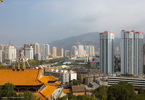 |
Xining city view |
|
GPS: |
na |
|
N/A |
|
|
|
|
|
|
 |
Xining others |
|
GPS: |
na |
|
N/A |
|
|
|
|
|
|
|
XUNHUA area |
|
|
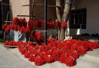 |
Chili
pepper |
xxxxxxxxxxxxx |
GPS: |
na |
|
N/A |
|
|
|
|
|
|
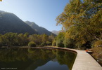 |
Heaven Lake (Tian Chi)
天池 |
|
GPS: |
35.79205,
102.67655 |
|
The pond covers and area of
20hectares, and is 30 meters in
depth. This pleasant reserve is
located in the mountains above
the Yellow River. Heaven Lake
(Tian Chi), is a sacred lake for
both the local Salar Muslims and
Tibetan Buddhists. The Salar
have their origins in Samarkand
and speak an isolated Turkic
language. |
|
|
|
|
|
|
 |
Mengda Nature Reserve
青海孟达国家级自然保护区 |
|
GPS: |
35.81267,
102.67525 |
|
T). |
|
|
|
|
|
|
 |
Tongren-Xunhua road |
|
GPS: |
na |
|
N/A |
|
|
|
|
|
|
 |
Xunhua market and City
循化撒拉族自治县 |
|
GPS: |
35.85115,
102.48913 |
|
N/A |
|
|
|
|
|
|
 |
Xunhua-Tian Chi Road |
|
GPS: |
na |
|
N/A |
|
|
|
|
|
|
 |
Xunhua-Xining Road |
|
GPS: |
na |
|
N/A |
|
|
|
|
|
|
|
OTHERS |
|
|
 |
Qinghai scenary |
|
GPS: |
na |
|
N/A |
|
|
|
|
|
|
 |
Solar heater |
|
GPS: |
na |
|
N/A |
|
|
|
|
|
|
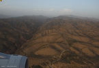 |
View from plane |
|
GPS: |
na |
|
N/A |
|
|
|
|
|
|


