|
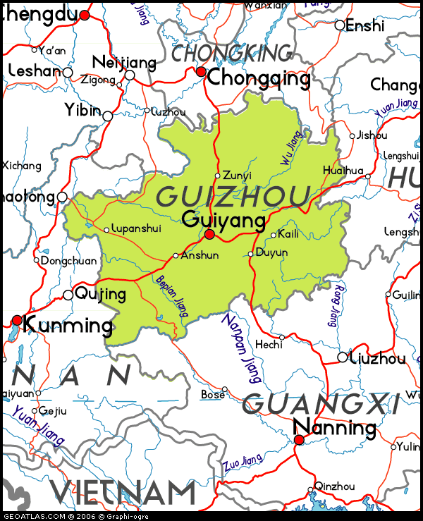
Landscapes in this province are broadly
divided in to four types: plateaus, mountains, hills and basins. Among
them, mountains and hills predominate. In addition, karst landforms are
distributed widely on this land, which accounts for 61.9% of the
province’s whole territory and forms a special Karst ecosystem. Due to
these rugged landscapes, its development level is low, especially in the
rural areas. However, it is these varied landscapes that hide an
abundance of amazing and unique natural scenery, like Huangguoshu
Waterfall, Dragon Palace Cave, Zhijin Cave and Danxia Landform. The
Danxia Landform is listed as a UNESCO World Cultural & Natural Heritage.
Guizhou has a subtropical humid monsoon climate, which is frequently
cloudy and rainy. There are few seasonal changes here with the result
that it is neither too cold in the winter nor too hot in the summer. Its
capital city, Guiyang, is considered a ‘world’s summer resort’ because
of the moderate temperature. |
|
ANSHUN area |
|
|
 |
Anshun City |
|
GPS: |
26.24533,
105.93303 |
|
Situated to the east of
Yunnan-Guizhou Plateau in the
mid-western part of Guizhou
Province, Anshun City has become
the center of tourism for the
western part of Guizhou. |
|
|
| |
|
|
|
|
|
|
|
Anshun Baita |
|
GPS: |
26.24055,
105.93319 |
|
Xixiushan Baita is one of the
three buildings of Anshun in the
Yuan Dynasty and is well
preserved. Xixiushan Baita is
one of the earliest ancient
famous towers in Guizhou. It was
called “Penfeng Cuicui” and was
included in the book “Chinese
Ancient Pagoda” edited by Mr.
Luo Zhewen, a national ancient
construction expert. |
 |
|
|
|
|
|
|
|
Anshun City |
|
GPS: |
26.24533,
105.93303 |
|
na |
 |
|
|
|
|
|
|
|
Anshun Confucian Temple |
|
GPS: |
26.24899,
105.93549 |
|
The Wenmiao Confucius Temple was
build during the Ming Dynasty
era in the 14th century and
bears some resemblance in style
and architecture with the
Forbidden City, which was build
in the same period. Is has 4
courtyards and it honours the
life and achievements of famous
philosopher Confucius and his
disciples. |
 |
|
|
|
|
|
|
|
Donglín Temple |
|
GPS: |
na |
|
na |
 |
|
|
|
|
|
|
|
Longwang Miao |
|
GPS: |
na |
|
A working Buddhist temple, just
off Zhonghua Beilu. |
 |
|
|
|
|
|
|
|
Temple |
|
GPS: |
na |
|
na |
 |
|
 |
Dragon
Palace |
xxxxxxxxxxxxx |
GPS: |
26.09224,
105.88924 |
|
Dragon Palace is national key
tourist attraction famous for
its unique karst landforms,
including karst cave, in-cave
waterfall, stone forests,
underground river, stalactite
and stalagmite. Dragon Palace is
crowned as "the wonder of
nature" by tourists. |
|
|
|
|
|
|
|
Longgong caves |
|
GPS: |
26.12013,
105.89616 |
|
Longgong Cave Scenic Area is a
comprehensive and concentrated
attraction highlighting karst
geological landscape such as
caves, canyons, waterfalls,
cliffs, streams, stone forests
and underground rivers. |
 |
|
|
|
|
Park-Waterfall |
|
GPS: |
na |
|
na |
 |
|
 |
Huangguoshu Waterfall |
|
GPS: |
25.98877,
105.66965 |
|
Huangguoshu Waterfall is the
largest waterfall in Asia.
Seventy-four meters (243 feet)
high and eighty-one meters (266
feet) wide, it is a scenic
marvel in Anshun. |
|
|
|
|
 |
Tianlong
Village |
|
GPS: |
26.35678,
106.16712 |
|
This tunpu (village fortress) in
Anshun, Guizhou, was built for
military use 600 years ago,
during the Ming Dynasty
(1368–1644 AD). |
|
|
|
|
 |
Tianxingqiao |
|
GPS: |
25.94067, 105.68221 |
|
Tianxingqiao is located
six kilometers away from
Huangguoshu Waterfall. The most
distinguished character of the
place is its abundance in water,
rocks, forests and caves, which
compose a picturesque view for
the visitors. |
|
|
|
|
 |
Others |
|
GPS: |
na |
|
na |
|
|
|
|
|
GUIYANG area |
|
|
 |
Guiyang City |
|
GPS: |
26.64766,
106.63015 |
|
Guiyang, capital of Guizhou
Province is a transfer point
between most China cities, and
the various ethnic minorities’
villages in the province. |
|
|
| |
|
|
|
|
|
|
|
City view |
|
GPS: |
26.64766,
106.63015 |
|
na |
 |
|
|
|
|
|
|
|
Cuiwei Gongyuan |
|
GPS: |
26.57096,
106.72003 |
|
This city park features a
restored Ming dynasty temple
with some picturesque pavilions.
It's a pleasant place to find
some respite from the city
noise. |
 |
|
|
|
|
|
|
|
Jiaxiu Pavillion |
|
GPS: |
26.5714,
106.71975 |
|
Jiaxiu Pavilion can be found
perched on the Nanming River in
downtown Guiyang. Originally
built in the Ming dynasty, the
tower has been rebuilt over the
years, with the currently
standing building dating from
1909. |
 |
|
|
|
|
|
|
|
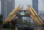
Rénmín Square |
|
GPS: |
26.56897,
106.71168 |
|
na |
 |
|
|
|
|
|
|
|
Wenchang Pavilion |
|
GPS: |
26.57878,
106.71922 |
|
Wenchang Pavilion is a
three-story pagoda-shaped
building and was originally
dedicated to the Taoist god
Mingchang. Because the corners
of domestic pavilion buildings
are even-numbered equal angles,
the Wenchang Pavilion with its
nine corners is very special. |
 |
|
 |
Qingyan Ancient Town |
|
GPS: |
26.33292,
106.68887 |
|
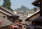
Qingyan Ancient Town, one of the
most famous historical and
cultural towns in Guizhou
Province, lies in the southern
suburb of Guiyang. As an ancient
town, covering an area of 300
hectares, Qingyan Town was
originally built in 1378. |
|
|
| |
|
|
|
|
|
|
|
Central road - Views |
|
GPS: |
na |
|
Walking inside the inner town,
visitors will surely marvel at
the ancient architecture here.
There are over 30 types
including monasteries, temples,
cabinets, caves, courtyards and
palaces. |
 |
|
|
|
|
|
|
|
Longquan temple |
|
GPS: |
26.3337,
106.68855 |
|
The Longquan Temple, the largest
Buddhist temple in the town. It
is located at the end of the
Northern Gate to the town. |
 |
|
|
|
|
|
|
|
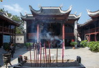
Wanshou Palace |
|
GPS: |
26.33076,
106.68757 |
|
na |
 |
|
|
|
|
|
|
|
Zhao temple |
|
GPS: |
26.33071,
106.68847 |
|
na |
 |
|
 |
Tianhetan |
|
GPS: |
26.44012,
106.5793 |
|
Tianhetan, with its beautiful
mountains and rivers and
pleasant climate since ancient
times, was once a hermit of
Wuzhong Tuo in the late Ming and
early Qing Dynasties, and left
many poems of praise. |
|
|
| |
|
 |
Zhenshan |
|
GPS: |
26.44794,
106.6141 |
|
Zhenshan features its primitive
stone houses and ethnic minority
customs. It was first built in
Ming Dynasty (1368-1644). It was
originally a military fort and
became the gathering point of
Bouyei ethnic group. |
|
|
| |
|
 |
Others |
|
GPS: |
na |
|
na |
|
|
|
|
|
KAILI area |
|
|
 |
Datang |
|
GPS: |
26.33763,
108.06994 |
|
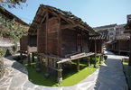
The Miao village of Datang, lost
in the hills of Guizhou is home
to Miao women with short skirts,
traditional dress very unusual
anywhere in China. It is also in
this village that are built
attics on stilts in ponds. |
|
|
| |
|
 |
Jidao |
|
GPS: |
26.48474,
108.08037 |
|
The Jidao Miao Village is
located in Sankeshu Town, Kaili
City, Qiadongnan Zhou. It is a
well-preserved Miao Village rich
in Miao ethnic spirit. The many
several hundred years old Miao
songs have made this place
unique. |
|
|
| |
|
 |
Leishan
area |
|
GPS: |
26.37844,
108.07754 |
|
Leishan is a small town in the
Guizhou Province partly
inhabited by Miou people who can
be seen all round town. |
|
|
|
|
 |
Lengde |
|
GPS: |
26.47707,
108.05843 |
|
na |
|
|
| |
|
 |
Xijiang |
|
GPS: |
26.49176,
108.17711 |
|
Being the largest gathering
place of the Miao in China and
even the world, about ten
natural Miao ethnic villages
exist in Xijiang Town and the
Miao culture is best preserved
in this area. |
|
|
| |
|
|
|
|
|
|
|
Commercial street |
|
GPS: |
na |
|
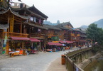
There are two main streets in
Xijiang Qianhu Miao Village, an
ancient one and a modern-built
Youfang Street. As well as
unique shops the old street has
many snacks stores, restaurants,
and silver products stores. |
 |
|
|
|
|
|
|
|
Hilltop-Rice fields view |
|
GPS: |
na |
|
na |
 |
|
|
|
|
|
|
|
Traditional village |
|
GPS: |
na |
|
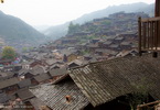
Xijiang Town and the Miao
culture is best preserved in
this area. According to the
latest statistics, there are
about 1,288 families with a
total population of around 6,000
people living there. |
 |
|
|
|
|
PORTRAITS OF GUIZHOU PEOPLES |
|
|
 |
Portraits |
|
GPS: |
na |
|
na |
|
|
|
|
|
|
|
ZHENYUAN |
|
|
 |
Qinglong
Cave |
|
GPS: |
27.0492,
108.43281 |
|
The mountains are described as
being upright, with large
cliffs, various rocks, and as
having many caves to explore.
Here there was a Qinglongdong
Ancient Architecture Complex
that was built in the middle of
the Ming Dynasty. |
|
|
|
|
 |
Wuyang River |
|
GPS: |
27.04877,
108.4259 |
|
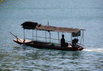
The charming Wuyang River runs
95 kilometers from Huangping,
down to Zhenyuan. This river is
characterized by natural
landscape of eight canyons,
historic sites and minority
ethnic flavor. |
|
|
| |
|
 |
Zhenyuan City |
|
GPS: |
27.0455,
108.41724 |
|
Zhenyuan has long been an
ancient town of the Miao people.
The town covers only an area of
3.1 square kilometers but greets
you with more than 160 scenic
spots including caves, palaces,
pavilions, temples and rivers
with their unique architecture. |
|
|
| |
|
|
|
|
|
|
|
Pagoda |
|
GPS: |
27.0497,
108.42056 |
|
na |
 |
|
|
|
|
|
|
|
River-City view |
|
GPS: |
na |
|
na |
 |
|
|
|
|
|
|
|
Weicheng wall |
|
GPS: |
na |
|
na |
 |
|
|
|
|
|
|
|
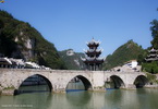
Zhusheng bridge |
|
GPS: |
27.05068,
108.43221 |
|
Zhenyuan’s old bridge is a
gorgeous and robust span of
arches topped with a
three-storey pavilion. |
 |
|
|
|
|
OTHERS |
|
|
 |
Folklore |
|
GPS: |
na |
|
na |
|
|
|
|
 |
Train
Kaili-Zhenyuan |
|
GPS: |
na |
|
na |
|
|
|
|
 |
Wooden
car |
|
GPS: |
na |
|
na |
|
|
|
|
 |
Others |
|
GPS: |
na |
|
na |
|
|
|
|
|
|
|
|
|
|


